
Abstract
The aim of this study is to establish a detailed and complete inventory of the landslides triggered by the Mj 7.3 (Mw 7.0) Kumamoto, Japan, earthquake sequence of 15 April 2016 (16 April in JST). Based on high-resolution (0.5–2 m) optical satellite images, we delineated 3,467 individual landslides triggered by the earthquake, occupying an area of about 6.9 km2. Then they were validated by aerial photographs with very high-resolution (better than 0.5 m) and oblique field photos. Of them, 3,460 landslides are distributed in an elliptical area about 6000 km2, with a NE-SW directed 120-km-long long axis and a 60-km-long NW-SE trending short axis. Most of the landslides are shallow, disrupted falls and slides, with a few flow-type slides and rock and soil avalanches. The analysis of correlation between the landslides and several control factors shows the areas of elevation 1000–1200 m, stratum of Q3-Hvf, seismic intensity VIII and VIII+, and peak ground acceleration (PGA) 0.4–0.6 g register the highest landslide abundance. This study also discussed the relationship between the spatial pattern of the landslides and the seismotectonic structure featured by a strike-slip fault with a normal component and the volcanism in the study area.


References
Active Fault Research Group (1991) Active faults in Japan: sheet maps and inventories (revised edition). University of Tokyo Press, Tokyo 437 pp
Alfaro P, Delgado J, García-Tortosa FJ, Lenti L, López JA, López-Casado C, Martino S (2012) Widespread landslides induced by the Mw 5.1 earthquake of 11 May 2011 in Lorca, SE Spain. Eng Geol 137-138:40–52. https://doi.org/10.1016/j.enggeo.2012.04.002
Amante C, Eakins BW (2009). ETOPO1 1 arc-minute global relief model: procedures, data sources and analysis, US Department of Commerce, National Oceanic and Atmospheric Administration, National Environmental Satellite, Data, and Information Service, National Geophysical Data Center, Marine Geology and Geophysics Division Colorado. https://www.ngdc.noaa.gov/mgg/global/relief/ETOPO1/docs/ETOPO1.pdf
Asano K, Iwata T (2016) Source rupture processes of the foreshock and mainshock in the 2016 Kumamoto earthquake sequence estimated from the kinematic waveform inversion of strong motion data. Earth Planets Space 68(1):147. https://doi.org/10.1186/s40623-016-0519-9
British Geological Survey, Earthquakes without Frontiers, Durham University (2015) 2015 Nepal earthquakes mapped landslide intensity (Revision 4.0–19 June 2015). https://data.hdx.rwlabs.org/group/nepal-earthquake
Dai Z, Wang F, Huang Y, Song K, Iio A (2016) SPH-based numerical modeling for the post-failure behavior of the landslides triggered by the 2016 Kumamoto earthquake. Soc Geogr Discuss 3(1):24. https://doi.org/10.1186/s40677-016-0058-5
Dang K, Sassa K, Fukuoka H, Sakai N, Sato Y, Takara K, Quang LH, Loi DH, Van Tien P, Ha ND (2016) Mechanism of two rapid and long-runout landslides in the 16 April 2016 Kumamoto earthquake using a ring-shear apparatus and computer simulation (LS-RAPID). Landslides 13(6):1525–1534. https://doi.org/10.1007/s10346-016-0748-9
Du W, Wang G (2014) Fully probabilistic seismic displacement analysis of spatially distributed slopes using spatially correlated vector intensity measures. Earthq Eng Struct Dyn 43(5):661–679. https://doi.org/10.1002/eqe.2365
Du W, Wang G (2016) A one-step Newmark displacement model for probabilistic seismic slope displacement hazard analysis. Eng Geol 205:12–23. https://doi.org/10.1016/j.enggeo.2016.02.011
Fujiwara S, Yarai H, Kobayashi T, Morishita Y, Nakano T, Miyahara B, Nakai H, Miura Y, Ueshiba H, Kakiage Y, Une H (2016) Small-displacement linear surface ruptures of the 2016 Kumamoto earthquake sequence detected by ALOS-2 SAR interferometry. Earth Planets Space 68(1):160. https://doi.org/10.1186/s40623-016-0534-x
Furumura T (2016) Destructive near-fault strong ground motion from the 2016 Kumamoto prefecture, Japan, M7.3 earthquake. Landslides 13(6):1519–1524. https://doi.org/10.1007/s10346-016-0760-0
Geological Survey of Japan (2012). AIST (ed.), Seamless digital geological map of Japan 1: 200,000. Jul 3, 2012 version. Research Information Database DB084, Geological Survey of Japan, National Institute of Advanced Industrial Science and Technology. https://gbank.gsj.jp/seamless/
Gnyawali KR, Maka S, Adhikari BR, Chamlagain D, Duwal S, Dhungana AR (2016). Spatial implications of earthquake induced landslides triggered by the April 25 Gorkha Earthquake Mw 7.8: preliminary analysis and findings. International Conference on Earthquake Engineering and Post Disastor Reconstruction Planning 24–26 April, 2016, Bhaktapur, Nepal: 50–58
Goda K, Campbell G, Hulme L, Ismael B, Ke L, Marsh R, Sammonds P, So E, Okumura Y, Kishi N, Koyama M, Yotsui S, Kiyono J, Wu S, Wilkinson S (2016) The 2016 Kumamoto earthquakes: cascading geological hazards and compounding risks. Front Built Environ 2:19
Gorum T, Korup O, van Westen CJ, van der Meijde M, Xu C, van der Meer FD (2014) Why so few? Landslides triggered by the 2002 Denali earthquake, Alaska. Quat Sci Rev 95:80–94. https://doi.org/10.1016/j.quascirev.2014.04.032
Goto H, Tsutsumi H, Toda S, Kumahara Y (2017) Geomorphic features of surface ruptures associated with the 2016 Kumamoto earthquake in and around the downtown of Kumamoto City, and implications on triggered slip along active faults. Earth Planets and Space 69(1):26. https://doi.org/10.1186/s40623-017-0603-9
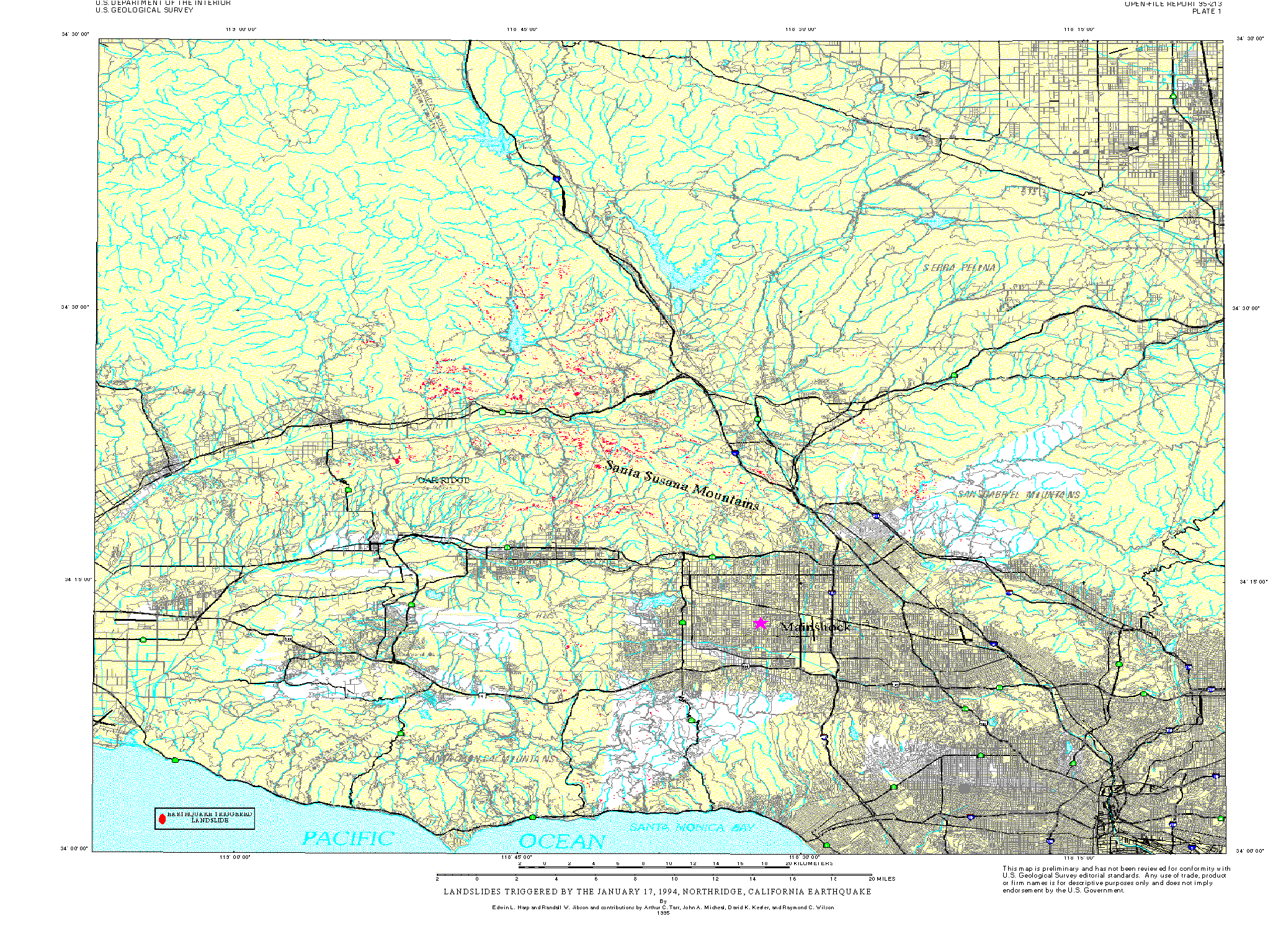
Harp EL, Jibson RW (1995) Inventory of landslides triggered by the 1994 Northridge, California earthquake. US Geological Survey, http://pubs.usgs.gov/of/1995/ofr-95-0213/plate1.gif; http://geo-nsdi.er.usgs.gov/metadata/open-file/95-213/
Harp EL, Keefer DK, Sato HP, Yagi H (2011) Landslide inventories: the essential part of seismic landslide hazard analyses. Eng Geol 122(1–2):9–21. https://doi.org/10.1016/j.enggeo.2010.06.013
Himematsu Y, Furuya M (2016) Fault source model for the 2016 Kumamoto earthquake sequence based on ALOS-2/PALSAR-2 pixel-offset data: evidence for dynamic slip partitioning (EPSP-D-16-00163). Earth Planets Space 68(1):169. https://doi.org/10.1186/s40623-016-0545-7
Jibson RW (2011) Methods for assessing the stability of slopes during earthquakes—a retrospective. Eng Geol 122(1–2):43–50. https://doi.org/10.1016/j.enggeo.2010.09.017
Kargel JS, Leonard GJ, Shugar DH, Haritashya UK, Bevington A, Fielding EJ, Fujita K, Geertsema M, Miles ES, Steiner J, Anderson E, Bajracharya S, Bawden GW, Breashears DF, Byers A, Collins B, Dhital MR, Donnellan A, Evans TL, Geai ML, Glasscoe MT, Green D, Gurung DR, Heijenk R, Hilborn A, Hudnut K, Huyck C, Immerzeel WW, Jiang L, Jibson R, Kääb A, Khanal NR, Kirschbaum D, Kraaijenbrink PDA, Lamsal D, Liu S, Lv M, McKinney D, Nahirnick NK, Nan Z, Ojha S, Olsenholler J, Painter TH, Pleasants M, Pratima KC, Qi Y, Raup BH, Regmi D, Rounce DR, Sakai A, Shangguan D, Shea JM, Shrestha AB, Shukla A, Stumm D, van der Kooij M, Voss K, Wang X, Weihs B, Wolfe D, Wu L, Yao X, Yoder MR, Young N (2016) Geomorphic and geologic controls of geohazards induced by Nepal’s 2015 Gorkha earthquake. Science 351(6269):aac8353
Kato A, Fukuda JI, Nakagawa S, Obara K (2016) Foreshock migration preceding the 2016 Mw 7.0 Kumamoto earthquake, Japan. Geophys Res Lett 43(17):8945–8953. https://doi.org/10.1002/2016GL070079
Kayen R, Dashti S, Kokusho T, Hazarika H, Franke K, Oettle N, Wham B, Calderon JR, Briggs D, Guillies S, Cheng K, Tanoue Y, Takematsu K, Matsumoto D, Morinaga T, Furuichi H, Kitano Y, Tajiri M, Chaudhary B, Nishimura K, Chu C (2016) Geotechnical aspects of the 2016 Mw 6.2, Mw 6.0, and Mw 7.0 Kumamoto earthquakes. Geotechnical Extreme Events Reconnaissance Association, Version 1.0, July 2016. https://pubs.er.usgs.gov/publication/70185571
Keefer DK (1984) Landslides caused by earthquakes. Geol Soc Am Bull 95(4):406–421. https://doi.org/10.1130/0016-7606(1984)95<406:LCBE>2.0.CO;2
Liao HW, Lee CT (2000) Landslides triggered by the Chi-Chi earthquake. Proceedings of the 21st Asian conference on remote sensing, Taipei 1–2:383–388
Matsumoto N, Yoshihiro H, Sawada A (2016) Continuity, segmentation and faulting type of active fault zones of the 2016 Kumamoto earthquake inferred from analyses of a gravity gradient tensor. Earth Planets Space 68(1):167. https://doi.org/10.1186/s40623-016-0541-y
Miyakawa A, Sumita T, Okubo Y, Okuwaki R, Otsubo M, Uesawa S, Yagi Y (2016) Volcanic magma reservoir imaged as a low-density body beneath Aso volcano that terminated the 2016 Kumamoto earthquake rupture. Earth Planets Space 68(1):208. https://doi.org/10.1186/s40623-016-0582-2
Moya L, Yamazaki F, Liu W, Chiba T (2017) Calculation of coseismic displacement from lidar data in the 2016 Kumamoto, Japan, earthquake. Nat Hazards Earth Syst Sci 17(1):143–156. https://doi.org/10.5194/nhess-17-143-2017
Nakata T, Imaizumi T (2002) Digital active fault map of Japan. University of Tokyo Press, Tokyo
NZSEE (2016) Learning from earthquakes mission: Kumamoto earthquake 2016, Japan. New Zealand Society for Earthquake Engineering Inc., http://www.eqclearinghouse.org/2016-04-15-kumamoto/files/2016/04/NZSEE_Kumamoto_Report.pdf
Okumura K (2016). Earthquake geology of the April 14 and 16, 2016 Kumamoto earthquakes, The Kumamoto Earthquake Investigation: a preliminary report, p 6. http://home.hiroshimau.ac.jp/kojiok/kumamoto2016KOreport2.pdf
Owen LA, Kamp U, Khattak GA, Harp EL, Keefer DK, Bauer MA (2008) Landslides triggered by the 8 October 2005 Kashmir earthquake. Geomorphology 94(1–2):1–9. https://doi.org/10.1016/j.geomorph.2007.04.007
Sano Y, Takahata N, Kagoshima T, Shibata T, Onoue T, Zhao D (2016) Groundwater helium anomaly reflects strain change during the 2016 Kumamoto earthquake in Southwest Japan. Sci Rep 6(1):37939. https://doi.org/10.1038/srep37939
Shen L, Xu C, Liu L (2016) Interaction among controlling factors for landslides triggered by the 2008 Wenchuan, China Mw 7.9 earthquake. Front Earth Sci 10(2):264–273
Sugito N, Goto H, Kumahara Y, Tsutsumi H, Nakata T, Kagohara K, Matsuta N, Yoshida H (2016) Surface fault ruptures associated with the 14 April foreshock (Mj 6.5) of the 2016 Kumamoto earthquake sequence, southwest Japan. Earth Planets Space 68(1):170. https://doi.org/10.1186/s40623-016-0547-5
Tatard L, Grasso JR (2013) Controls of earthquake faulting style on near field landslide triggering: the role of coseismic slip. J Geophys Res Solid Earth 118(6):2953–2964
Tian Y, Xu C, Xu X, Chen J (2016) Detailed inventory mapping and spatial analyses to landslides induced by the 2013 Ms 6.6 Minxian earthquake of China. J Earth Sci 27(6):1016–1026. https://doi.org/10.1007/s12583-016-0905-z
Toda S, Kaneda H, Okada S, Ishimura D, Mildon ZK (2016) Slip-partitioned surface ruptures for the Mw 7.0 16 April 2016 Kumamoto, Japan, earthquake. Earth Planets Space 68(1):188. https://doi.org/10.1186/s40623-016-0560-8
Tsuji T, Ishibashi JI, Ishitsuka K, Kamata R (2017) Horizontal sliding of kilometre-scale hot spring area during the 2016 Kumamoto earthquake. Sci Rep 7:42947. https://doi.org/10.1038/srep42947
Uchide T, Horikawa H, Nakai M, Matsushita R, Shigematsu N, Ando R, Imanishi K (2016) The 2016 Kumamoto–Oita earthquake sequence: aftershock seismicity gap and dynamic triggering in volcanic areas. Earth Planets Space 68(1):180. https://doi.org/10.1186/s40623-016-0556-4
US Geological Survey (2016) M 7.0 - 1km E of Kumamoto-shi, Japan. Map Version 8, https://earthquake.usgs.gov/earthquakes/eventpage/us20005iis#executive
Wang WN, Wu HL, Nakamura H, Wu SC, Ouyang S, Yu MF (2003) Mass movements caused by recent tectonic activity: the 1999 Chi-Chi earthquake in central Taiwan. Island Arc 12(4):325–334. https://doi.org/10.1046/j.1440-1738.2003.00400.x
Wang HB, Sassa K, Xu WY (2007) Analysis of a spatial distribution of landslides triggered by the 2004 Chuetsu earthquakes of Niigata prefecture, Japan. Nat Hazards 41(1):43–60. https://doi.org/10.1007/s11069-006-9009-x
Xu C (2015) Preparation of earthquake-triggered landslide inventory maps using remote sensing and GIS technologies: principles and case studies. Geosci Front 6(6):825–836. https://doi.org/10.1016/j.gsf.2014.03.004
Xu C, Xu X (2014) Statistical analysis of landslides caused by the Mw 6.9 Yushu, China, earthquake of April 14, 2010. Nat Hazards 72(2):871–893. https://doi.org/10.1007/s11069-014-1038-2
Xu C, Xu X, Yu G (2013) Landslides triggered by slipping-fault-generated earthquake on a plateau: an example of the 14 April 2010, Ms 7.1, Yushu, China earthquake. Landslides 10(4):421–431. https://doi.org/10.1007/s10346-012-0340-x
Xu C, Xu X, Shen L, Dou S, Wu S, Tian Y, Li X (2014a) Inventory of landslides triggered by the 2014 Ms 6.5 Ludian earthquake and its implications on several earthquake parameters. Seismol Geol 36(4):1186–1203
Xu C, Xu X, Shyu JBH, Zheng W, Min W (2014b) Landslides triggered by the 22 July 2013 Minxian-Zhangxian, China, Mw 5.9 earthquake: inventory compiling and spatial distribution analysis. J Asian Earth Sci 92:125–142. https://doi.org/10.1016/j.jseaes.2014.06.014
Xu C, Shyu JBH, Xu X (2014c) Landslides triggered by the 12 January 2010 Port-au-Prince, Haiti, Mw = 7.0 earthquake: visual interpretation, inventory compiling, and spatial distribution statistical analysis. Nat Hazards Earth Syst Sci 14(7):1789–1818. https://doi.org/10.5194/nhess-14-1789-2014
Xu C, Xu X, Yao X, Dai F (2014d) Three (nearly) complete inventories of landslides triggered by the May 12, 2008 Wenchuan Mw 7.9 earthquake of China and their spatial distribution statistical analysis. Landslides 11(3):441–461. https://doi.org/10.1007/s10346-013-0404-6
Xu C, Xu X, Shyu JBH (2015a) Database and spatial distribution of landslides triggered by the Lushan, China Mw 6.6 earthquake of 20 April 2013. Geomorphology 248:77–92. https://doi.org/10.1016/j.geomorph.2015.07.002
Xu C, Xu X, Shyu JBH, Gao M, Tan X, Ran Y, Zheng W (2015b) Landslides triggered by the 20 April 2013 Lushan, China, Mw 6.6 earthquake from field investigations and preliminary analyses. Landslides 12(2):365–385. https://doi.org/10.1007/s10346-014-0546-1
Xu C, Xu X, Tian Y, Shen L, Yao Q, Huang X, Ma J, Chen X, Ma S (2016a) Two comparable earthquakes produced greatly different coseismic landslides: the 2015 Gorkha, Nepal and 2008 Wenchuan, China events. J Earth Sci 27(6):1008–1015. https://doi.org/10.1007/s12583-016-0684-6
Xu C, Xu X, Shen L, Yao Q, Tan X, Kang W, Ma S, Wu X, Cai J, Gao M, Li K (2016b) Optimized volume models of earthquake-triggered landslides. Sci Rep 6(1):29797. https://doi.org/10.1038/srep29797
Xu C, Tian Y, Zhou B, Ran H, Lyu G (2017) Landslide damage along Araniko highway and Pasang Lhamu highway and regional assessment of landslide hazard related to the Gorkha, Nepal earthquake of 25 April 2015. Geoenvironmental Disasters 4(1):14. https://doi.org/10.1186/s40677-017-0078-9
Acknowledgments
We thank Aitaro Kato for his help in collecting data used in this study. We are grateful to the anonymous reviewers for their suggestive comments.
Funding
This study was supported by the major international (regional) joint research project (41661144037) from the National Natural Science Foundation of China (NSFC) and the International Centre for Integrated Mountain Development (ICIMOD) and the National Key Research and Development Program of China (Project No. 2017YFB0504104).
Author information
Authors and Affiliations
Corresponding author
Rights and permissions
About this article

Cite this article
Xu, C., Ma, S., Tan, Z. et al. Landslides triggered by the 2016 Mj 7.3 Kumamoto, Japan, earthquake. Landslides 15, 551–564 (2018). https://doi.org/10.1007/s10346-017-0929-1
Received:
Accepted:
Published:
Issue Date:
DOI: https://doi.org/10.1007/s10346-017-0929-1